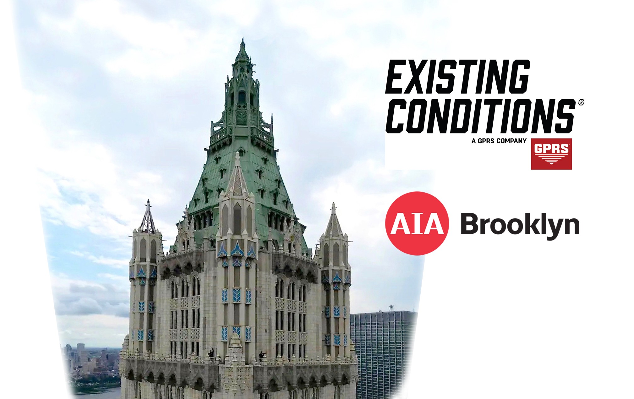
How could the top of the Woolworth Building (depicted above) be accurately surveyed? This webinar by Existing Conditions / GPRS show you how.
The role of drones in reality capture and building documentation continues to evolve rapidly every year. With billions of dollars in research and development going towards the unmanned aerial vehicle industry, many previously cost-prohibitive services are now within reach of most architects and building industry professionals. FAA-certified pilots can help you leverage drones to the fullest, and when combined with an exterior building scan using terrestrial laser scanning, architects and building owners often find that aerial drone surveys can be a great complement or alternative to a full 3D Revit model or CAD exterior elevations. In this course, the team from Existing Conditions will provide attendees with the information they need to leverage drone technology to properly evaluate the conditions of their buildings through the use of photographic, thermographic, and photogrammetric data.
1.0 LU